Since the FAA and local government agencies have started cracking down on recreational drone piloting, it's been pretty hard to get out the old drone and go flying, especially if you're wanting to get some aerial footage. In my area, there are at least a half dozen helicopter pads, and nearly as many small airports, making impossible to fly with the FAA regulation of 5 miles.
But that's all about to change thanks to a new program.
What is that new program?
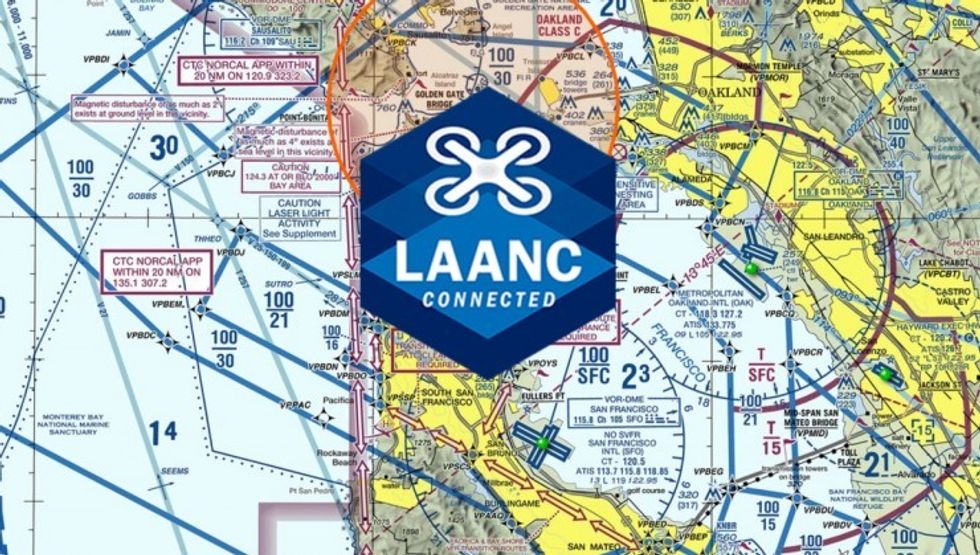
It's called the Low Altitude Authorization and Notification Capability System (LAANC), and it will enable recreational drone pilots to receive authorization instantly through a mobile device, granting them permission to fly within the controlled airspace of 600 airports. That opens up an estimated 2,000 square miles of airspace for UAV operations.
“Opening the LAANC system to recreational drone pilots is an important step in the FAA’s efforts to safely integrate drones into American skies by providing innovative solutions to regulatory requirements.”
Here's a quick overview of what's involved:
The news was welcomed by DJI, which has been lobbying the FAA pretty hard to open up airspace to commercial and now recreational drone pilots. DJI worked with the FAA last year to open up airspace for commercial pilots, and after a nearly spotless record, the FAA seemed to agree it was time to test their regulations and give recreational pilots the opportunity to fly in more areas.
“Drones have earned an admirable safety record around the world, and the FAA has recognized that they may be operated safely in certain areas near airports by both professional and recreational operators,” said Brendan Schulman, DJI Vice President of Policy & Legal Affairs. “Opening the LAANC system to recreational drone pilots is an important step in the FAA’s efforts to safely integrate drones into American skies by providing innovative solutions to regulatory requirements.”
Through LAANC, the FAA identifies locations where recreational drone operations could be considered safe and opens them up to users who file a virtual flight plan through their mobile device. The LAANC system will then grant immediate approval in most cases, and then pass the flight plan on to local Air Traffic Control Facilities for monitoring and situational awareness.
It's a win-win for both sides.
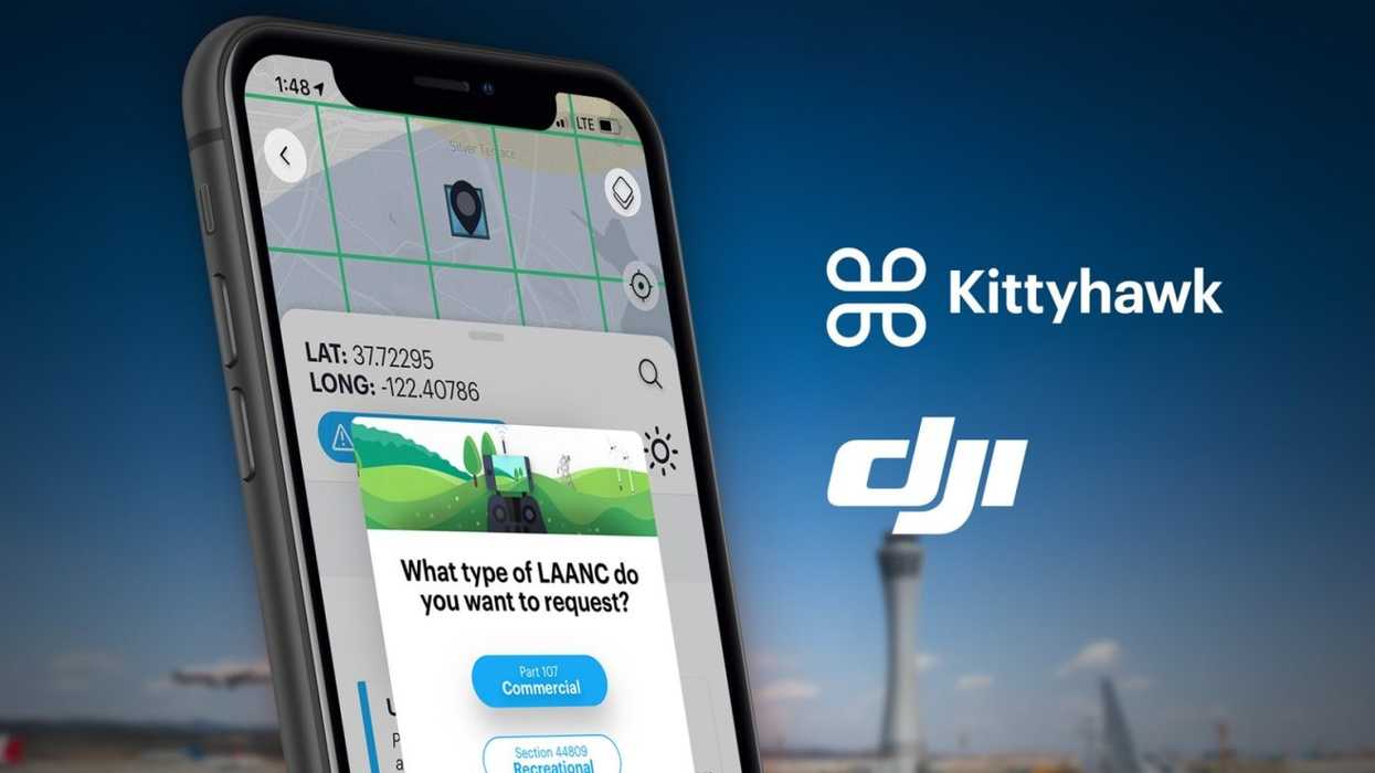
Kittyhawk also provides situational awareness for drone pilots, giving them access to not only local civil and commercial flight activity, but also other drone operations in your area. Plus, it will help you file a flight plan from up to 30 days in the future.
Here's a quick video on how to use it:
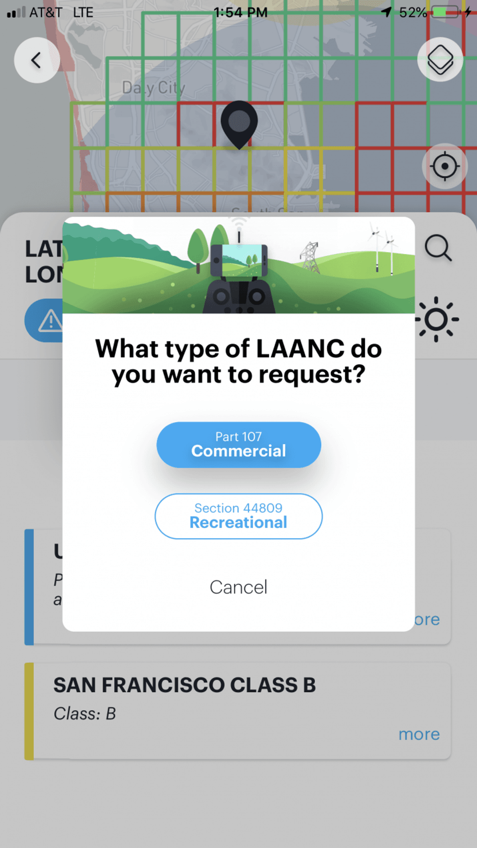
Through Kittyhawk, you can actually draw your flight area, letting the pilot know when their planned flight path goes beyond the FAA line of site regulation. Pilots must also provide a drone registration number, advise how long their flight will last, and the maximum altitude planned.
Then, the pilot will agree to a compliance check, reminding them of what rules are in force, and then submits that information directly to the FAA. Authorization is usually approved within seconds (or minutes), but there are instances where a flight path may need to be rejected due to planned flight operations like fighting a forest fire. A record of all authorizations is kept within the app as well. KittyHawk is available in both the iOS and Google Play stores as a free download.
Another good app to keep on your phone is B4 You Fly, the FAA's official drone app. It gives users a visual look at the airspace in their area, including the location of all controlled airspace areas, airports, and helipads. It's a very valuable tool when it comes to planning your drone flight.
Up next?
If you're into drones, check out this post on Moment's anamorphic lens for DJI drones. Moment is a smartphone lens maker, and this anamorphic